
Madhya Pradesh Launches AI-Based Real-Time Forest Alert System
| Category | Details |
|---|---|
| Event | Madhya Pradesh implements AI-based real-time forest alert system, becoming the first state in India to do so. |
| Technology Used | Google Earth Engine, AI models, and multi-temporal satellite data. |
Mains Relevant
| Category | Details |
|---|---|
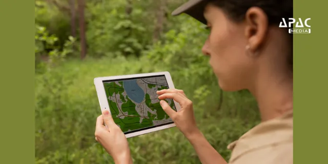
| Pilot Locations | Shivpuri, Guna, Vidisha, Burhanpur, and Khandwa districts. Plans to expand state-wide in the future. |
| Purpose | Proactively manage forests by detecting forest encroachment, land use change, and degradation. |
| Features | - Analyzes satellite images from three dates.- Uses NDVI, SAVI, EVI, SAR indexes.- Flags changes as polygon alerts. |
| App Features | GPS-tagged photos, voice notes, comments, geofencing, distance measurement. Filters like date, density, and area available on the dashboard. Field workers can upload photos, GPS, voice notes. |
| Government Initiatives | - Green India Mission (GIM): Increased forest cover by 0.56% (2017-2021).- National Agroforestry Policy (2014): Encourages tree planting on farmland.- Trees Outside Forests Program. |
| Corporate & Community Efforts | - CSR-Driven Plantations by industries like automobile, cement, and energy.- Agroforestry for Livelihoods: Farmers integrate timber, fruit, and medicinal plants with crops. |
| Carbon Credit Strategies | Industries invest in afforestation to earn carbon credits. |